


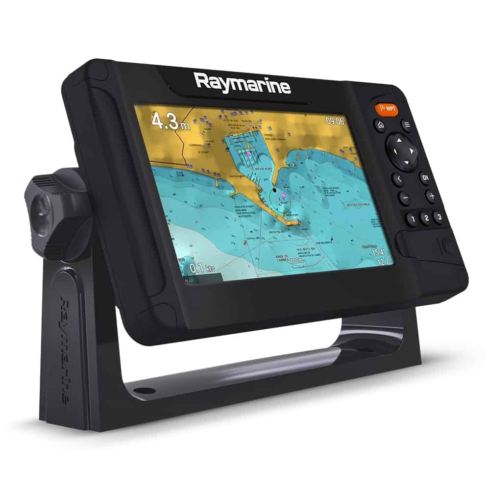
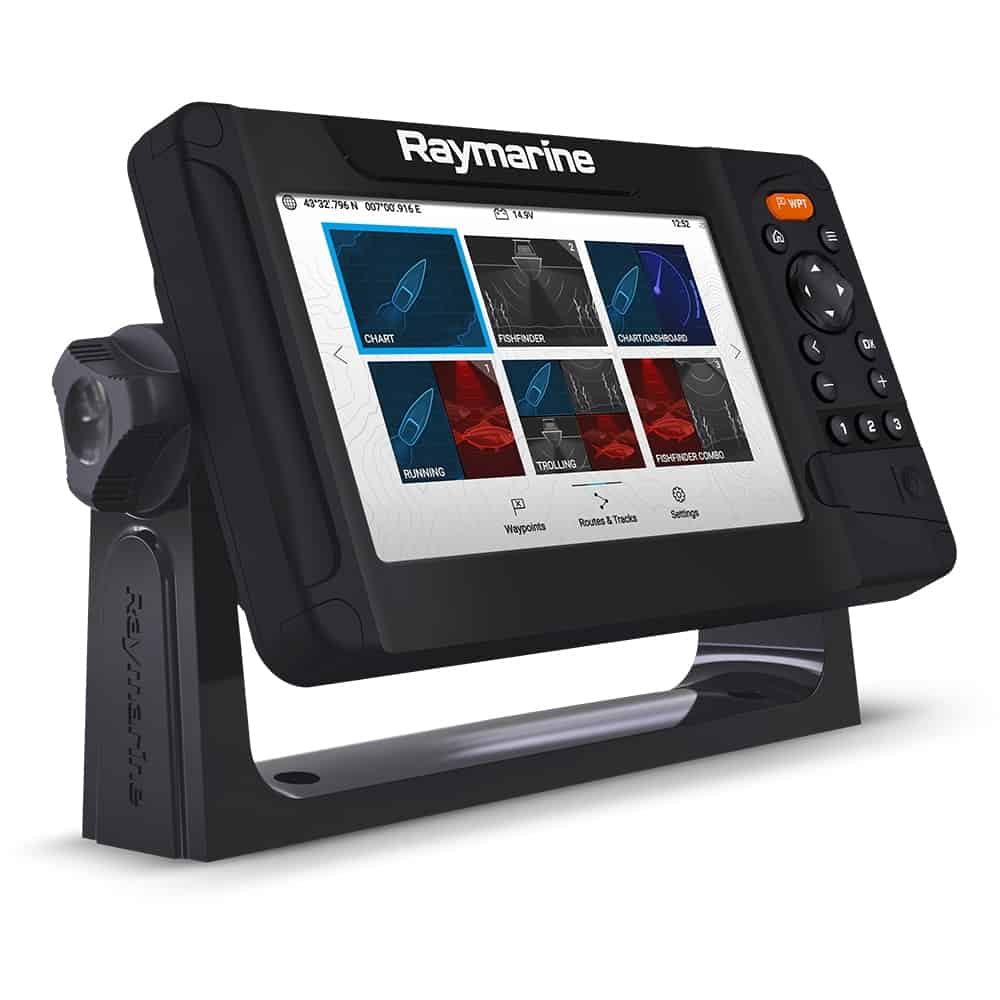
Raymarine Element 7 S Chartplotter + LightHouse Charts Western Europe
Discover precise navigation with the Raymarine Element 7 S Chartplotter, featuring intuitive LightHouse Charts for Western Europe, ensuring safe and efficient marine exploration with its advanced sonar and easy-to-use touchscreen interface.
Description
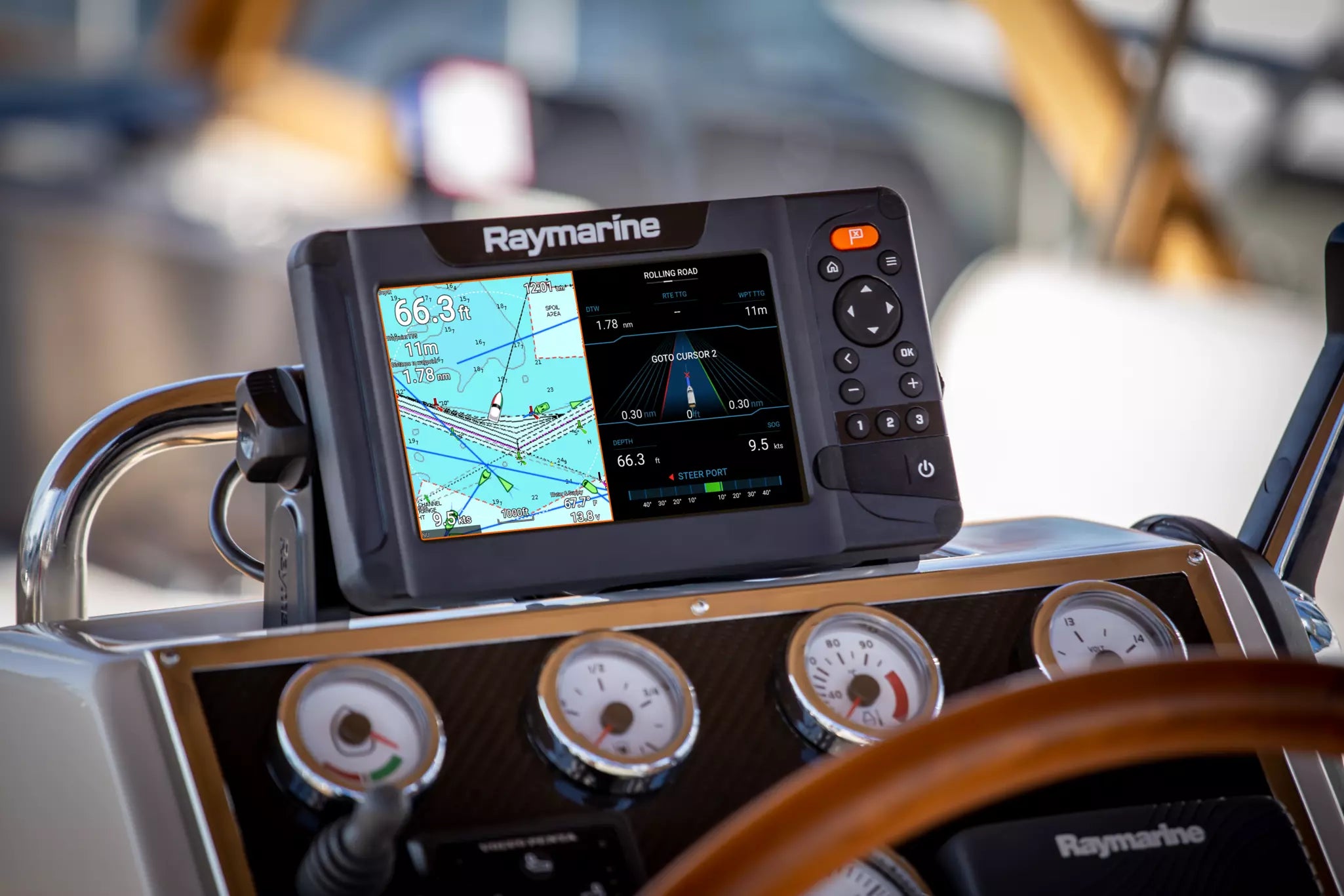
The Raymarine Element 7 S Chartplotter, paired with LightHouse Charts for Western Europe, delivers exceptional navigation capabilities for both recreational and professional marine users. This advanced chartplotter features a 7-inch, sunlight-readable display with high contrast and a user-friendly interface, enabling effortless viewing and operation even in bright conditions. The Element 7 S utilizes Raymarine's powerful RealVision 3D sonar technology, providing unparalleled imaging of the underwater environment, enhancing your understanding of depth, structure, and fish targets below your vessel. Equipped with LightHouse Charts, the Raymarine Element 7 S delivers precise mapping of Western Europe’s diverse coastal regions, ensuring accurate navigation through busy harbors and intricate waterways. With a comprehensive set of pre-loaded vector charts and compatibility for additional updates, mariners can enjoy constant access to the latest navigational data. The chartplotter supports multiple connectivity options, including built-in Wi-Fi, allowing seamless integration with mobile devices and other marine instruments. Users can easily create and manage routes, mark waypoints, and share information across compatible devices, making the Element 7 S an optimal choice for those navigating in unfamiliar waters. Constructed for reliability, the Element 7 S is designed to withstand the demanding conditions of the marine environment and features an IPX6/7 waterproof rating. This ensures durability and longevity, providing peace of mind for avid boaters and marine professionals alike. Overall, the Raymarine Element 7 S Chartplotter with LightHouse Charts offers a robust solution for navigational accuracy, making it an essential tool for safely exploring the seas of Western Europe.
Specification
| Specification | Details |
|---|---|
| Display Size | 7 inches |
| Display Type | SolarMax™ display |
| Resolution | 800 x 480 pixels |
| Touchscreen | Yes |
| GPS Receiver | Internal 10 Hz GPS |
| Chart Type | LightHouse Charts |
| Chart Coverage | Western Europe |
| Sonar Capability | Yes (optional) |
| Networking | Raynet, NMEA 2000, Wi-Fi |
| Power Supply | 12V DC |
| Dimensions | Approx. 8.9 x 5.5 x 3.5 inches |
| Weight | Approx. 2.2 lbs |
| Waterproof Rating | IPX6 and IP |