


Raymarine Axiom+ 7 Chartplotter + Lighthouse Charts Western Europe
The Raymarine Axiom+ 7 Chartplotter with Lighthouse Charts for Western Europe offers advanced navigation with its intuitive touchscreen interface. Featuring an intuitive design, it provides crystal-clear mapping, real-time data, and exceptional performance on the water. With high-resolution displays and powerful charting capabilities, it's perfect for boaters seeking reliability and precision. The Axiom+ 7 integrates seamlessly with various marine systems, enhancing your boating experience. Ideal for coastal cruising and fishing trips, this chartplotter ensures you're always on course and informed during your marine adventures.
Description
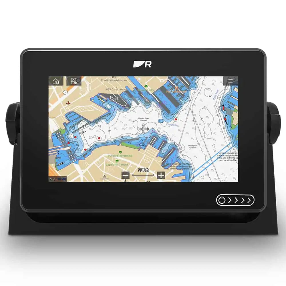
The Raymarine Axiom+ 7 Chartplotter, paired with Lighthouse Charts for Western Europe, is an advanced marine navigation solution designed for serious boaters and maritime professionals. This 7-inch multi-touch display offers a bright, high-resolution screen with a 170-degree viewing angle, ensuring clear visibility in varying light conditions. Equipped with Raymarine’s powerful Quantum technology, the Axiom+ 7 features a fast quad-core processor, enabling seamless operations and swift access to charts, apps, and features. The intuitive LightHouse OS simplifies navigation and chartplotting, providing users with easy access to navigation tools, weather information, and a variety of marine applications. The included Lighthouse Charts for Western Europe ensure comprehensive coverage, featuring detailed coastal maps, buoy data, and points of interest that are essential for safe and efficient navigation. Users can quickly plot routes, mark waypoints, and access real-time data to enhance their navigation experience. The Axiom+ 7 is also compatible with a wide array of Raymarine accessories, including radar, sonar, and thermal cameras, allowing for customized installations based on individual boating needs. Whether you're sailing, cruising, or fishing, the Raymarine Axiom+ 7 Chartplotter offers robust marine navigation capabilities combined with a user-friendly interface. Its durable design is built to withstand the rigors of marine environments, while its wireless connectivity features allow for easy sharing and access to navigation information from smartphones or tablets. Ideal for both recreational boaters and commercial operators, this chartplotter is an indispensable tool for navigating the waters of Western Europe with confidence.
Specification
| Product Name | Raymarine Axiom+ 7 Chartplotter + Lighthouse Charts Western Europe |
| Display Size | 7 inches |
| Display Type | Multi-touch display |
| Resolution | 800 x 480 pixels |
| Weight | 1.3 kg (2.9 lbs) |
| Dimensions (WxHxD) | 210 x 140 x 60 mm (8.3 x 5.5 x 2.4 in) |
| Power Consumption | Max 12W |
| Power Supply | 12V DC |
| Input Voltage | 10.5 - 16V DC |
| Waterproof Rating | IPX6 and IPX7 |
| Chart Coverage | Western Europe |
| Chart Format | Lighthouse Charts |
| Connectivity | NMEA 2000, Wi-Fi, Bluetooth |
| GPS Receiver | Internal 10 Hz GPS |
| Map Updates | Free map updates for one year |
| Certifications | CE, FCC, IC, and RoHS compliant |