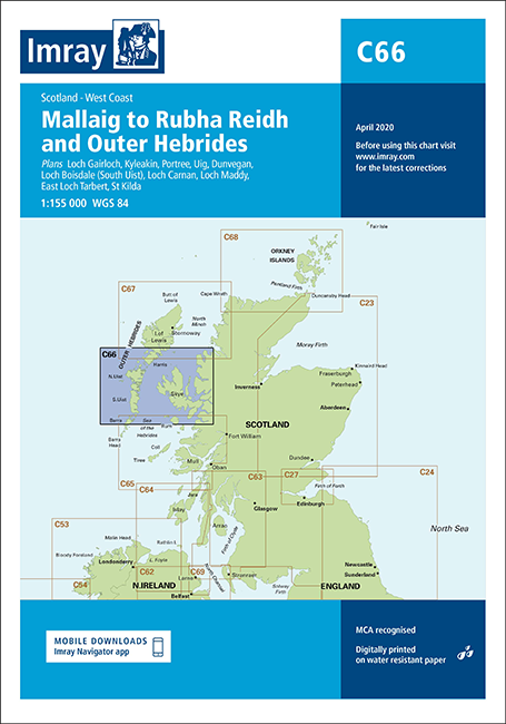
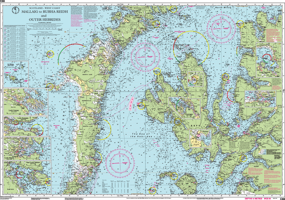
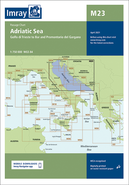
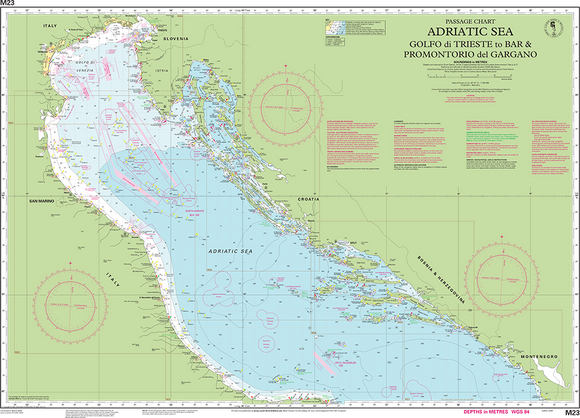
Nautical Charts

Nautical Charts

Explore the seas with confidence using our comprehensive Nautical Charts Collection. Carefully selected from leading publishers including Imray, our charts provide detailed, reliable, and up-to-date information for safe navigation along the UK coastline and beyond.

From busy harbours and coastal passages to open waters, each chart features accurate depth soundings, tidal streams, navigational aids, buoyage, lights, and hazards, helping skippers plan and execute their voyages safely. Printed on durable, water-resistant paper, our charts are designed to withstand marine conditions while remaining easy to handle onboard.

Filters

Filters
Sort by:

13 products

Imray C65 Crinan to Mallaig and BarraImray C65 Crinan to Mallaig and Barra
Imray C25 Harwich to River Humber & Holland ChartImray C25 Harwich to River Humber & Holland Chart
Save £2.95
Imray C29 Harwich to WhitbyImray C29 Harwich to Whitby
Imray
Imray C29 Harwich to Whitby Sale price£23.00 Regular price£25.95
Imray Irish Sea C62 ChartImray Irish Sea C62 Chart
Imray C66 Mallaig to Rudha Reidh and Outer HebridesImray C66 Mallaig to Rudha Reidh and Outer Hebrides
Imray M23 Adriatic Sea Passage ChartImray M23 Adriatic Sea Passage Chart
Imray C27 Firth of ForthImray C27 Firth of Forth
Imray C24 Flamborough Head to Fife NessImray C24 Flamborough Head to Fife Ness
Imray C23 Fife Ness to Duncansby HeadImray C23 Fife Ness to Duncansby Head
ImrayChart  Firth Of Clyde C63ImrayChart  Firth Of Clyde C63
Imray C64 Belfast Lough To Lough Foyle & CrinanImray C64 Belfast Lough To Lough Foyle & Crinan
Imray C67 North Minch and Isle of LewisImray C67 North Minch and Isle of Lewis
Imray C68 Cape Wrath to Wick and the Orkney IslandsImray C68 Cape Wrath to Wick and the Orkney Islands