Imray C25 Harwich to River Humber & Holland Chart
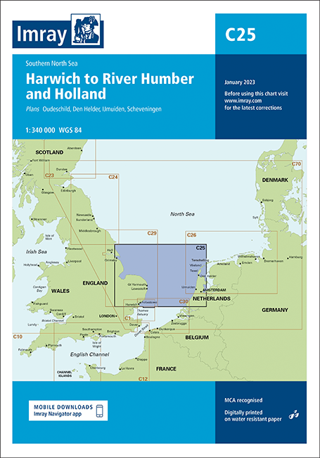
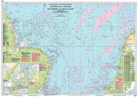
The Imray C25 Harwich to River Humber & Holland Chart is an essential navigation tool for mariners and recreational boaters. This detailed nautical chart features accurate topography, essential waypoints, and updated navigational information for safe passage across the busy waters of the eastern UK coast. Printed on durable, water-resistant material, it’s perfect for both professional and leisure use. Whether you’re planning a coastal excursion or working in the marine industry, the Imray C25 ensures you navigate with confidence and precision.
Out of stock items can be ordered and shipped out within 3-5 working days
We despatch all orders within 24 hours. Orders placed weekdays before 4pm will be shipped the same day.
Call us and speak to an expert on 0191 4297309 - (Mon - Fri / 9am - 5pm).
Pickup available at Marine Chandlery: North Shields
Usually ready in 1 hour

Imray C25 Harwich to River Humber & Holland Chart
Marine Chandlery: North Shields
Unit G4 Narvik Way
Tyne Tunnel Trading Estate
North Shields NE29 7XJ
United Kingdom

The Imray C25 Harwich to River Humber & Holland Chart is an essential navigation tool for mariners and recreational boaters. This detailed nautical chart features accurate topography, essential waypoints, and updated navigational information for safe passage across the busy waters of the eastern UK coast. Printed on durable, water-resistant material, it’s perfect for both professional and leisure use. Whether you’re planning a coastal excursion or working in the marine industry, the Imray C25 ensures you navigate with confidence and precision.
The Imray C25 Harwich to River Humber & Holland Chart is an essential navigation tool for mariners and recreational boaters. This detailed nautical chart features accurate topography, essential waypoints, and updated navigational information for safe passage across the busy waters of the eastern UK coast. Printed on durable, water-resistant material, it’s perfect for both professional and leisure use. Whether you’re planning a coastal excursion or working in the marine industry, the Imray C25 ensures you navigate with confidence and precision.
Description
The Imray C25 Harwich to River Humber & Holland Chart is an essential tool for mariners navigating the East Coast of England and the waterways of the Netherlands. This detailed nautical chart offers precise information on coastal features, port facilities, and navigational hazards, ensuring safe and efficient passage for both leisure and commercial boating. Key features of the Imray C25 include high-resolution mapping that displays depths, buoy placements, tidal streams, and landmarks critical for navigation. The chart is printed on durable, water-resistant paper, designed to withstand the rigors of marine environments, making it ideal for use on the deck or in the cockpit. It also benefits from a comprehensive index of ports and harbors, providing key information quickly and easily. Typical use cases for the Imray C25 encompass recreational sailing, fishing expeditions, and commercial shipping operations. Coastal and offshore fishermen will find the detailed bathymetry advantageous in locating fishing grounds, while leisure sailors can navigate with confidence using the clearly marked routes and hazards. Practical benefits of this chart include its ability to enhance navigational safety by providing up-to-date information critical for avoiding underwater obstacles and ensuring compliance with local regulations. Additionally, it serves as a reliable reference during bad weather or when electronic navigation systems may fail, ensuring that mariners remain informed and secure while on the water. The Imray C25 Harwich to River Humber & Holland Chart is a trusted resource vital to the safe and effective navigation of the waterways it covers, making it a valuable addition to the navigational toolkit of any marine user.
Specification
| Specification | Details |
|---|---|
| Chart Title | Imray C25 Harwich to River Humber & Holland |
| Scale | 1:200,000 |
| Dimensions | 1000 mm x 700 mm |
| Publication Date | 2020 |
| Edition | 3rd Edition |
| Format | Paper |
| ISBN | 978-1-84067-096-3 |
| Coverage | Harwich to River Humber, including Holland |
| Features | Depths, Navigation Aids, Landmarks |
Delivery information
Standard delivery: 3-5 working days
Express delivery: 1-2 working days
Free delivery on orders over £100


