Navionics Vision+™ – Irish Sea NVEU004R microSD™/SD™
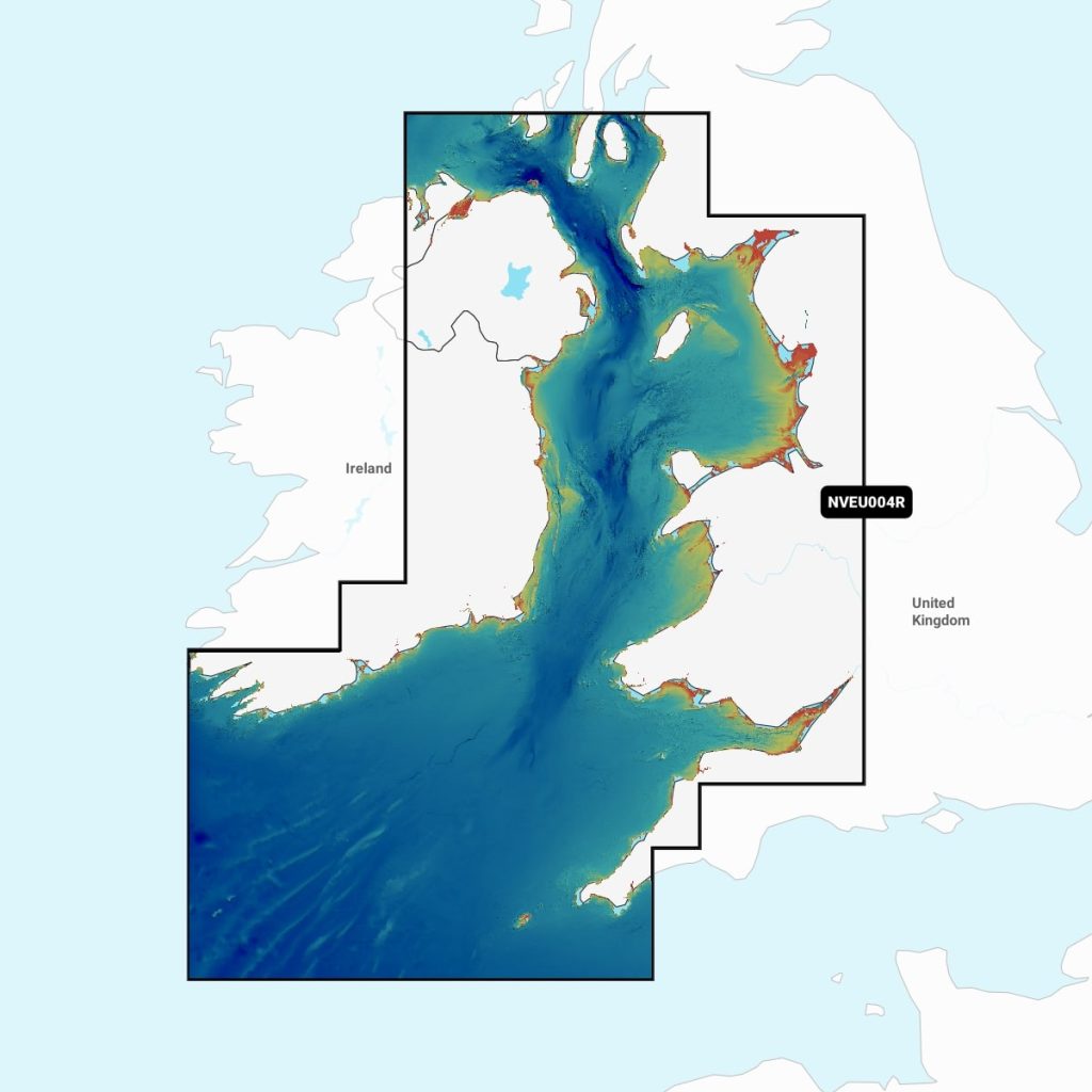
Enhance your maritime navigation with the Navimaps Garmin Navionics Vision+ for the Irish Sea. This advanced marine chart offers precise cartography, detailed bathymetric data, and real-time updates to ensure safe sailing. With features like high-resolution satellite imagery and integrated navigation tools, it provides critical insights for both recreational and professional mariners. Ideal for planning routes and avoiding hazards, this chart is essential for anyone navigating the picturesque yet challenging waters of the Irish Sea.
Out of stock items can be ordered and shipped out within 3-5 working days
We despatch all orders within 24 hours. Orders placed weekdays before 4pm will be shipped the same day.
Call us and speak to an expert on 0191 4297309 - (Mon - Fri / 9am - 5pm).
Pickup available at Marine Chandlery: North Shields
Usually ready in 1 hour

Navionics Vision+™ – Irish Sea NVEU004R microSD™/SD™
Marine Chandlery: North Shields
Unit G4 Narvik Way
Tyne Tunnel Trading Estate
North Shields NE29 7XJ
United Kingdom

Enhance your maritime navigation with the Navimaps Garmin Navionics Vision+ for the Irish Sea. This advanced marine chart offers precise cartography, detailed bathymetric data, and real-time updates to ensure safe sailing. With features like high-resolution satellite imagery and integrated navigation tools, it provides critical insights for both recreational and professional mariners. Ideal for planning routes and avoiding hazards, this chart is essential for anyone navigating the picturesque yet challenging waters of the Irish Sea.
Enhance your maritime navigation with the Navimaps Garmin Navionics Vision+ for the Irish Sea. This advanced marine chart offers precise cartography, detailed bathymetric data, and real-time updates to ensure safe sailing. With features like high-resolution satellite imagery and integrated navigation tools, it provides critical insights for both recreational and professional mariners. Ideal for planning routes and avoiding hazards, this chart is essential for anyone navigating the picturesque yet challenging waters of the Irish Sea.
Description
Current usage has exceeded your plan's limits. Please follow the upgrade instructions at https://sheetgpt.ai/articles/managing-upgrading-or-downgrading-your-sheetgpt-plan to increase your plan's usage limits.
Specification
| Specification | Details |
|---|---|
| Product Name | Garmin Navionics Vision+ Irish Sea |
| Coverage Area | Irish Sea |
| Chart Type | Raster and Vector Charts |
| Features | 3D View, Aerial Imagery, Satellite Imagery |
| Compatibility | Garmin Chartplotters |
| Update Frequency | Regular Updates |
| Format | MicroSD/SD Card |
| Dimensions | Standard MicroSD Card Size |
| Weight | Lightweight |
| Manufacturer | Garmin |
Delivery information
Standard delivery: 3-5 working days
Express delivery: 1-2 working days
Free delivery on orders over £100


