Imray C27 Firth of Forth
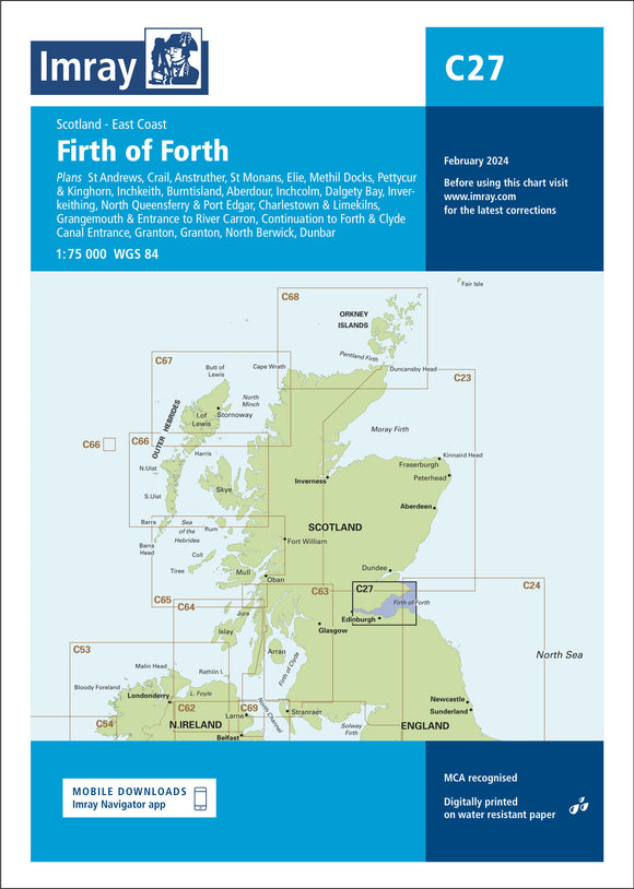
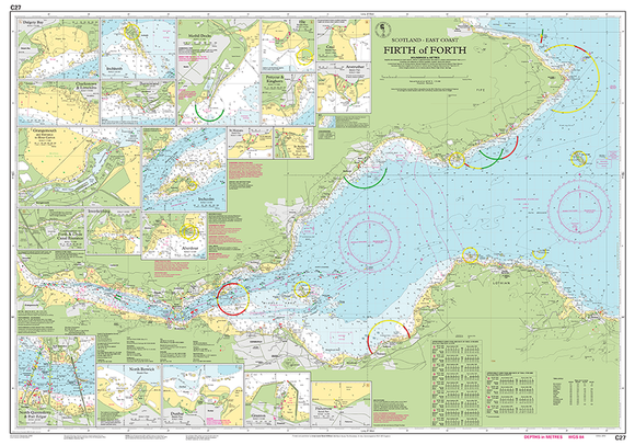
The Imray C27 Firth of Forth chart provides comprehensive and up-to-date navigation information for the estuary and surrounding coastal waters. Featuring detailed depth soundings, tidal streams, navigational aids, buoys, lights, and hazards, it is ideal for yachtsmen, powerboaters, and small craft operators navigating one of Scotland’s busiest waterways. Printed on durable, water-resistant paper and folded for convenience, this chart combines accuracy, clarity, and durability for reliable coastal and passage planning.
Out of stock items can be ordered and shipped out within 3-5 working days
We despatch all orders within 24 hours. Orders placed weekdays before 4pm will be shipped the same day.
Call us and speak to an expert on 0191 4297309 - (Mon - Fri / 9am - 5pm).
Pickup currently unavailable at Marine Chandlery: North Shields

Imray C27 Firth of Forth
Marine Chandlery: North Shields
Unit G4 Narvik Way
Tyne Tunnel Trading Estate
North Shields NE29 7XJ
United Kingdom

The Imray C27 Firth of Forth chart provides comprehensive and up-to-date navigation information for the estuary and surrounding coastal waters. Featuring detailed depth soundings, tidal streams, navigational aids, buoys, lights, and hazards, it is ideal for yachtsmen, powerboaters, and small craft operators navigating one of Scotland’s busiest waterways. Printed on durable, water-resistant paper and folded for convenience, this chart combines accuracy, clarity, and durability for reliable coastal and passage planning.
The Imray C27 Firth of Forth chart provides comprehensive and up-to-date navigation information for the estuary and surrounding coastal waters. Featuring detailed depth soundings, tidal streams, navigational aids, buoys, lights, and hazards, it is ideal for yachtsmen, powerboaters, and small craft operators navigating one of Scotland’s busiest waterways. Printed on durable, water-resistant paper and folded for convenience, this chart combines accuracy, clarity, and durability for reliable coastal and passage planning.
Description
The Imray C27 Firth of Forth chart is a professional-grade nautical chart covering the estuary and coastal waters of the Firth of Forth, including Edinburgh, Fife, and surrounding areas. Designed for yachtsmen, powerboaters, and small craft operators, it provides comprehensive hydrographic information, ensuring safe navigation through one of the UK’s busiest waterways.
Produced by Imray Laurie Norie & Wilson Ltd, the chart features Imray’s clear and user-friendly cartographic style, combining official hydrographic data with easy-to-read symbols and colour coding. It includes depth soundings, tidal streams, navigational aids, buoys, lights, wrecks, and restricted areas, helping skippers plan coastal passages and pilotage safely.
Printed on durable, water-resistant chart paper, the chart is suitable for onboard use and frequent handling. Folded for convenience, the C27 remains a reliable and practical tool for navigation in the Firth of Forth.
Specification
| Specification | Detail |
|---|---|
| Chart Number | C27 |
| Coverage Area | Firth of Forth |
| Geographic Region | East Coast of Scotland (Edinburgh & Fife regions) |
| Publisher | Imray Laurie Norie & Wilson Ltd |
| Chart Type | Nautical Chart (Folded) |
| Format | Paper Chart – Folded |
| Paper Type | Durable, water-resistant chart paper |
| Scale | 1:50,000 – 1:75,000 (varies across chart sections) |
| Depth Soundings | In metres with contour shading |
| Included Data | Buoyage, lights, tidal streams, wrecks, restricted areas, coastal features |
| Usage | Coastal navigation, passage planning, pilotage |
| Update Status | Corrected to latest known notices (check edition date on chart) |
| Edition | Regularly revised and updated by Imray |
Delivery information
Standard delivery: 3-5 working days
Express delivery: 1-2 working days
Free delivery on orders over £100


