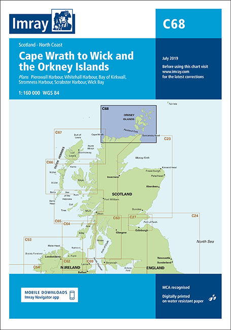
Imray C68 Cape Wrath to Wick and the Orkney Islands
Discover Chart C68 for Cape Wrath to Wick & Orkney Islands, featuring detailed topographic information, essential for safe navigation and exploration in marine environments. Ideal for sailors and marine enthusiasts.
Out of stock items can be ordered and shipped out within 3-5 working days
We despatch all orders within 24 hours. Orders placed weekdays before 4pm will be shipped the same day.
Call us and speak to an expert on 0191 4297309 - (Mon - Fri / 9am - 5pm).
Pickup available at Marine Chandlery: North Shields
Usually ready in 1 hour

Imray C68 Cape Wrath to Wick and the Orkney Islands
Marine Chandlery: North Shields
Unit G4 Narvik Way
Tyne Tunnel Trading Estate
North Shields NE29 7XJ
United Kingdom

Discover Chart C68 for Cape Wrath to Wick & Orkney Islands, featuring detailed topographic information, essential for safe navigation and exploration in marine environments. Ideal for sailors and marine enthusiasts.
Discover Chart C68 for Cape Wrath to Wick & Orkney Islands, featuring detailed topographic information, essential for safe navigation and exploration in marine environments. Ideal for sailors and marine enthusiasts.
Description
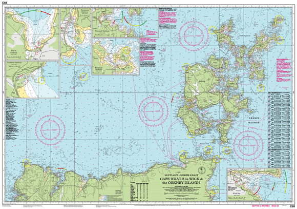
The Chart C68: Cape Wrath to Wick & The Orkney Islands is an essential navigational resource for both recreational boaters and professional mariners. This high-quality, detailed nautical chart is specially designed to provide accurate information for navigating these complex waters, ensuring safety and efficiency on your voyage. Key features of the C68 chart include precise depth contours, navigational aids, and critical geographical landmarks, enabling sailors to make informed decisions while at sea. The chart covers significant areas including Cape Wrath, the northern coast of Scotland, and the picturesque Orkney Islands, showcasing important channels and anchorage spots. Typical use cases for the C68 chart range from planning coastal sailing excursions to conducting scientific research and surveying maritime routes. Its durability and water-resistant material make it suitable for extended use in various weather conditions, ensuring the chart remains intact and legible. Marine users benefit from the clear, high-contrast print and user-friendly layout, which simplifies navigation even in challenging waters. With the Chart C68, sailors can enhance their maritime knowledge and improve navigation accuracy, making it an indispensable tool for maritime adventures. Whether you are a seasoned skipper or a novice sailor, this chart is designed to support safe and enjoyable maritime experiences.
Specification
| Product Name | Chart Cape Wrath To Wick & The Orkney Islands C68 |
| Type | Marine Nautical Chart |
| Scale | 1:200,000 |
| Dimensions | 29.7 cm x 42.0 cm (A3 size) |
| Material | Paper |
| Weight | Approx. 150 g |
| Region Covered | Cape Wrath to Wick and Orkney Islands |
| Edition Date | Latest Publication Date |
| Certifications | Approved by the UK Hydrographic Office |
| Usage | Recreational and Commercial Navigational Use |
Delivery information
Standard delivery: 3-5 working days
Express delivery: 1-2 working days
Free delivery on orders over £100


