Navionics+™ Mediterranean Sea, Southeast NSEU016R microSD™/SD™
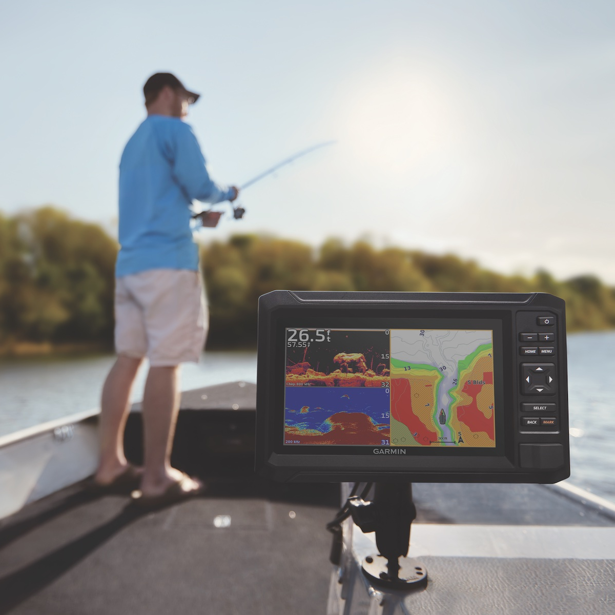
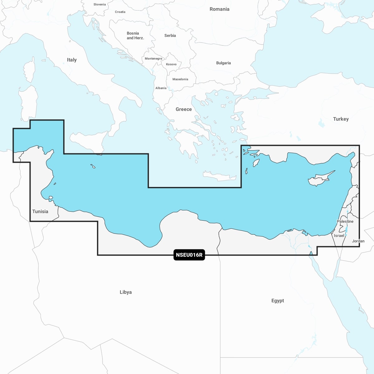
The Navionics Mediterranean Sea, Southeast chart provides detailed nautical maps for safe navigation in this stunning region. With high-resolution bathymetric data, it offers essential features like depth contours, port management, and navigational aids. Ideal for leisure boaters and professionals alike, this product ensures accurate route planning and real-time updates for marine safety. Compatible with a variety of chartplotters, the Navionics Southeast chart enhances your maritime experience, making it an indispensable tool for navigating the beautiful Mediterranean waters.
Out of stock items can be ordered and shipped out within 3-5 working days
We despatch all orders within 24 hours. Orders placed weekdays before 4pm will be shipped the same day.
Call us and speak to an expert on 0191 4297309 - (Mon - Fri / 9am - 5pm).
Pickup available at Marine Chandlery: North Shields
Usually ready in 1 hour

Navionics+™ Mediterranean Sea, Southeast NSEU016R microSD™/SD™
Marine Chandlery: North Shields
Unit G4 Narvik Way
Tyne Tunnel Trading Estate
North Shields NE29 7XJ
United Kingdom

The Navionics Mediterranean Sea, Southeast chart provides detailed nautical maps for safe navigation in this stunning region. With high-resolution bathymetric data, it offers essential features like depth contours, port management, and navigational aids. Ideal for leisure boaters and professionals alike, this product ensures accurate route planning and real-time updates for marine safety. Compatible with a variety of chartplotters, the Navionics Southeast chart enhances your maritime experience, making it an indispensable tool for navigating the beautiful Mediterranean waters.
The Navionics Mediterranean Sea, Southeast chart provides detailed nautical maps for safe navigation in this stunning region. With high-resolution bathymetric data, it offers essential features like depth contours, port management, and navigational aids. Ideal for leisure boaters and professionals alike, this product ensures accurate route planning and real-time updates for marine safety. Compatible with a variety of chartplotters, the Navionics Southeast chart enhances your maritime experience, making it an indispensable tool for navigating the beautiful Mediterranean waters.
Description
Navionics Mediterranean Sea, Southeast is an essential electronic navigation tool specifically designed for mariners operating in the southeastern Mediterranean region. This detailed charting solution features high-resolution nautical charts that cover diverse areas, including popular cruising destinations, harbors, and commercial shipping routes. The primary advantage of Navionics Mediterranean Sea, Southeast lies in its up-to-date cartographic information, which is enhanced through daily updates via the Navionics Boating app. This ensures users navigate with the latest data, reducing the risk of errors while at sea. The charts incorporate essential navigation aids and coastal features, including depth contours, hazardous areas, and safety information critical for planning any marine voyage. A notable feature is the sonar chart layer, which provides 1-foot contours for key areas, making it advantageous for fishermen and professional mariners who require precise depth information. Additionally, the Community Edits feature allows users to contribute local knowledge regarding underwater hazards and navigational challenges, thus enriching the overall navigational data. Common use cases include leisure boating, fishing expeditions, shipping logistics, and coastal navigation. The detailed route planning tools enable users to plot optimized paths, taking into account current weather conditions and tidal information, contributing to safer and more efficient navigation. Navionics Mediterranean Sea, Southeast is compatible with a variety of marine chart plotters and can be utilized on mobile devices, providing versatility for onboard use and smartphone navigation. This product is an indispensable asset for avid sailors, marine professionals, and recreational boaters looking to enhance their navigation experience in the southeast Mediterranean.
Specification
| Specification | Details |
|---|---|
| Product Name | Navionics Mediterranean Sea, Southeast |
| Coverage Area | Southeast Mediterranean Sea |
| Chart Type | Raster and Vector Charts |
| Compatibility | Compatible with various marine devices and apps |
| Updates | Annual updates available |
| Features | Depth contours, navigational aids, port details |
| Format | Digital format for marine navigation |
| Language | Multiple languages supported |
| Price | Varies by retailer |
Delivery information
Standard delivery: 3-5 working days
Express delivery: 1-2 working days
Free delivery on orders over £100


