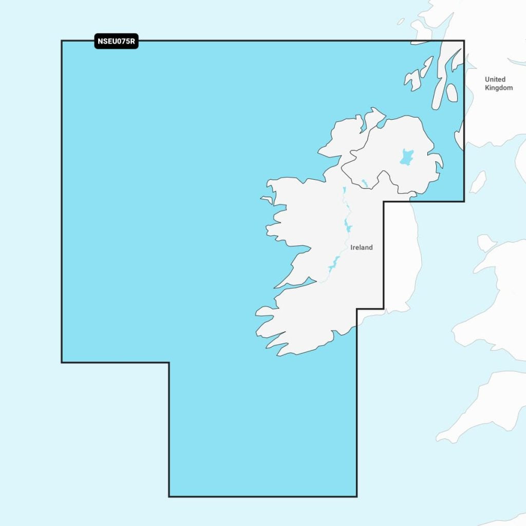
Navionics+™ - Ireland, West Coast NSEU075R microSD™/SD™
Explore the waters of the Irish Sea with Navimaps Garmin Irish Sea charts. Designed for mariners, these high-resolution maps provide accurate details on coastlines, harbors, and waterways. Compatible with Garmin devices, they offer easy navigation and enhanced situational awareness. Ideal for sailing, fishing, or recreational boating, the Navimaps ensure safety and precision on every voyage. With their user-friendly interface and up-to-date information, these charts are essential for any marine enthusiast. Navigate confidently with Navimaps Garmin Irish Sea.
Out of stock items can be ordered and shipped out within 3-5 working days
We despatch all orders within 24 hours. Orders placed weekdays before 4pm will be shipped the same day.
Call us and speak to an expert on 0191 4297309 - (Mon - Fri / 9am - 5pm).
Pickup available at Marine Chandlery: North Shields
Usually ready in 1 hour

Navionics+™ - Ireland, West Coast NSEU075R microSD™/SD™
Marine Chandlery: North Shields
Unit G4 Narvik Way
Tyne Tunnel Trading Estate
North Shields NE29 7XJ
United Kingdom

Explore the waters of the Irish Sea with Navimaps Garmin Irish Sea charts. Designed for mariners, these high-resolution maps provide accurate details on coastlines, harbors, and waterways. Compatible with Garmin devices, they offer easy navigation and enhanced situational awareness. Ideal for sailing, fishing, or recreational boating, the Navimaps ensure safety and precision on every voyage. With their user-friendly interface and up-to-date information, these charts are essential for any marine enthusiast. Navigate confidently with Navimaps Garmin Irish Sea.
Explore the waters of the Irish Sea with Navimaps Garmin Irish Sea charts. Designed for mariners, these high-resolution maps provide accurate details on coastlines, harbors, and waterways. Compatible with Garmin devices, they offer easy navigation and enhanced situational awareness. Ideal for sailing, fishing, or recreational boating, the Navimaps ensure safety and precision on every voyage. With their user-friendly interface and up-to-date information, these charts are essential for any marine enthusiast. Navigate confidently with Navimaps Garmin Irish Sea.
Description
The Navimaps Garmin Irish Sea is a detailed and comprehensive marine chart designed specifically for navigating the waters of the Irish Sea. Compatible with a wide range of Garmin chartplotters, this product provides essential navigational data, including coastline details, depth contours, buoy locations, and critical navigational aids. Key features of the Navimaps Garmin Irish Sea include high-resolution satellite imagery and up-to-date cartographic information that ensures accurate route planning and safe navigation. The chart displays key maritime boundaries, important shipping routes, and detailed marina information, making it an indispensable tool for both recreational sailors and professional mariners. Typical use cases for the Navimaps Garmin Irish Sea range from day sailing and fishing trips to long-distance cruising, where precision navigation is crucial. This chart aids in avoiding hazards and optimizing routes, contributing to safer and more efficient journeys across the Irish Sea. The practical benefits of using Navimaps Garmin Irish Sea include enhanced situational awareness and improved navigation efficiency. The user-friendly interface allows for easy integration with Garmin devices, ensuring that users can quickly access vital information while underway. Whether you are an experienced sailor or a novice boater, the Navimaps Garmin Irish Sea equips you with the essential tools for confident navigation in this dynamic marine environment.
Specification
| Specification | Details |
|---|---|
| Product Name | Navimaps Garmin Irish Sea |
| Coverage Area | Irish Sea |
| Format | Garmin Compatible |
| Scale | 1:50,000 |
| Features | Detailed charts, navigation aids, depth contours |
| Updates | Regular updates available |
| Compatibility | Garmin GPS devices |
| Language | English |
| File Size | Varies by version |
Delivery information
Standard delivery: 3-5 working days
Express delivery: 1-2 working days
Free delivery on orders over £100


